Tracks Beneath the City: Hamilton's Hidden Railway Story
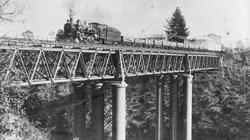
Train crossing Claudelands Rail Bridge, c.1918, HCL_02097
By the 1880s, the rapid development of farming and early tourism in the Waikato region created a growing need for reliable transport. Land was being cleared between the Waikato River and the Kaimai Ranges, and towns like Te Aroha were beginning to attract visitors. In response, the railway line was extended across the Waikato River toward Morrinsville, opening up a vital east–west corridor.True to the engineering preferences of the time, the route followed the flattest possible path, necessitating a railway bridge across the Waikato River. That bridge, now known as the Claudelands Road Bridge, opened in 1884. At the time, the railway passed directly over Victoria Street. With only two trains a day and a local population of around 1,200, the railway’s right of way where all road traffic stopped for trains was not seen as a significant inconvenience.
Fast-forward 80 years to the 1960s, and Hamilton’s population had soared to nearly 58,000. The arrival of motor vehicles and a boom in both road and rail traffic dramatically changed the urban landscape. What had once been a sleepy level crossing became a notorious bottleneck, particularly during peak hours, as road traffic was routinely halted for increasingly frequent and longer trains. Throughout the early 20th century, the railway expanded rapidly. By the 1890s, branch lines to Rotorua and Thames had opened, followed by lines to Tauranga. In the 1950s, industrial centres like Tokoroa and the Kinleith Mill became major users of the railway network. The line through Hamilton now supported passengers and freight moving to and from Morrinsville, Te Aroha, Paeroa, Waihi, Whakatāne, Kawerau, Putāruru, Te Puke, and beyond.
But that same growth placed enormous pressure on Hamilton’s central crossings, especially Victoria Street. As early as 1912, the Hamilton Borough Council proposed lowering the railway line to avoid traffic disruption. They tried again in 1919 and proposed redirecting the line in 1929. Each time, the Railway Department resisted the changes. By the late 1930s, with traffic and frustration mounting, the Railways Department developed preliminary plans to lower the line. But the estimated cost £529,000 (about $50 million in today’s money) was far beyond what the Council could manage. Progress stalled again.
Finally, in the 1950s, the National Roads Board backed a new approach. The decision was made to reroute and sink the railway line, constructing a corridor that would pass under the city, relieving the long-standing congestion issue. In September 1959, the Ministry of Works began construction. The solution involved cutting a new route twenty feet below the river’s surface level and gradually rising back to ground level at Frankton. Overbridges were constructed at Tristram/Hinemoa, Seddon Streets, and Lake Road. The new underground line opened in 1964 and the railway bridge was repurposed to be the Claudelands Bridge we know and still use today.
Included in the new project was Hamilton Central Station, an underground stop beneath what is now the Transport Centre and Warehouse building. The rail line runs beneath Centreplace Mall, roughly between (and parallel to) Ward Street and Bryce Street. From the river’s edge near the ASB building to just west of Anglesea Street, the line remains entirely covered.The construction method used was known as “cut and cover”: a large trench was dug, a concrete roof was added, and the area was filled in effectively burying the once-busy railway line.Where trains had once thundered visibly across Hamilton, they now moved almost silently below ground. The transformation changed not only the flow of traffic, but the visual and cultural landscape of the city centre.
After the underground line opened, the old rail yard was used as a car park until the development of Centreplace and the Transport Centre. New government buildings were erected on the former station site. Today, there is little to suggest a railway once bisected Victoria Street. To the casual passer-by, it’s as if it was never there at all. But beneath the city’s streets, the tracks remain reminding us that Hamilton’s present-day ease of movement was hard-won through decades of negotiation, expansion, and bold infrastructure change.
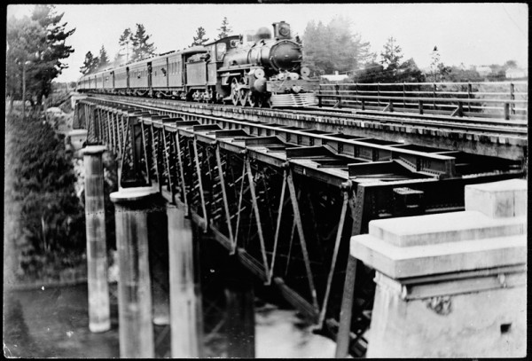
Express train crossing bridge over Waikato River, c.1912, HCL_02361
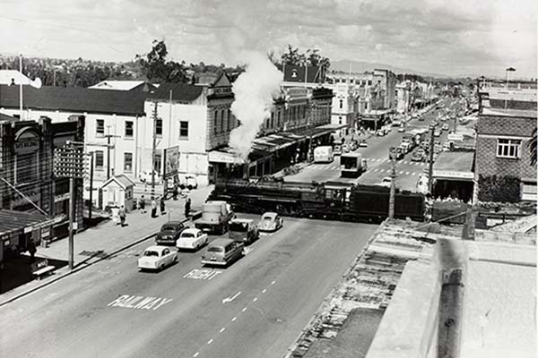
Train crossing Victoria St, 1959, HCL_02106
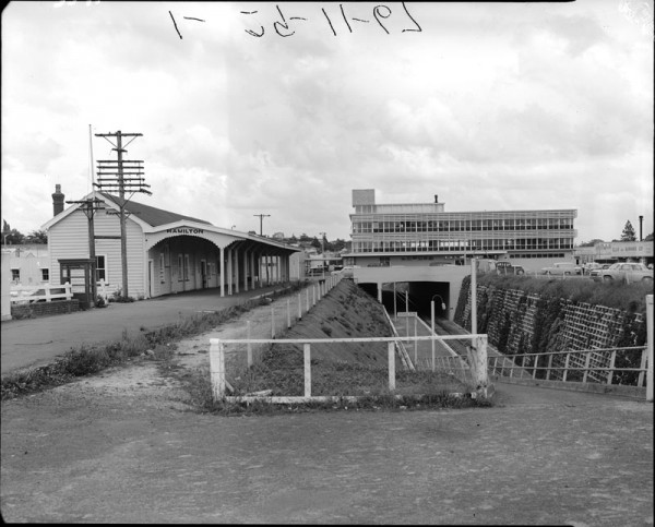
Hamilton Railway Station and lowered railway line, 1965, HCL_03571
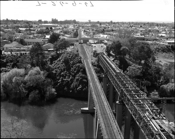
New and old rail bridges, before the conversion from rail to road, 1967, HCL_03548