The Great Flood of 1907: When the Waikato Went Underwater
In January 1907, Aotearoa experienced one of the most severe floods in its recorded history. An intense deluge of rain swept across the central North Island, from Taupoo to Auckland, beginning with three days of relentless downpour, followed by a week of steady, soaking rain.
The Waikato region was particularly impacted. With few stop banks in place at the time, the floodwaters quickly overwhelmed riverbanks and floodplains. Entire towns and rural communities, especially those in low-lying areas between Mercer and Hamilton, as well as in Morrinsville, found themselves submerged. Grain crops were devastated, households in flood-prone zones were forced to evacuate, and infrastructure was left in ruins.
Several bridges were swept away, key roads became impassable, and communication with outlying districts was severed. Rail services between Hamilton and Auckland were suspended for nearly a month, a significant disruption in an era when rail was a vital lifeline for goods and people.
Remarkably, despite the scale of the destruction, there were no reported fatalities.
Historic weather events like the 1907 flood are a reminder of the power of nature and the vulnerability of early settlements. They also offer valuable insights into how communities have responded to and rebuilt from disaster.
If you’re interested in learning more about Hamilton’s past extreme weather events, visit our Special Collections team on Level 3 at Central Library, or explore our digital archives.
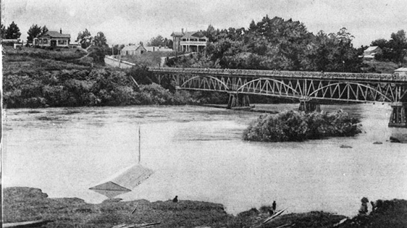
HCL_02880, Hamilton City Libraries
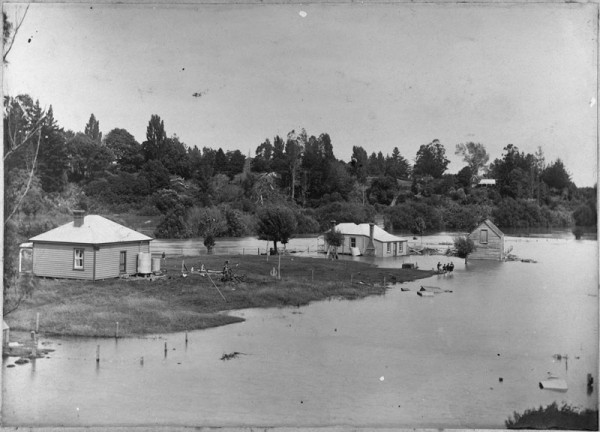
This is another photo showing the flooded river. You can see Isaac Coates home ‘Wairere’ in the background on the right in this photo.
HCL_01438, Hamilton City Libraries
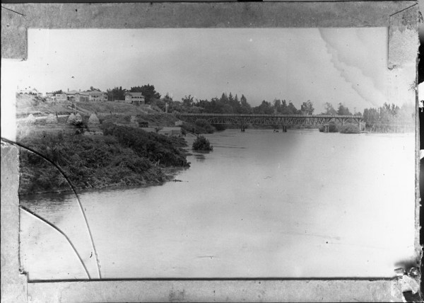
This image shows the Waikato River in flood in front of the Union Bridge.