Overground, underground, the evolution of railway in Hamilton
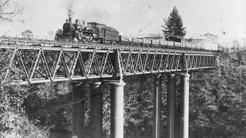
Train crossing Claudelands Rail Bridge, c.1918, HCL_02097
By 1884 the economic activity of the Waikato district demanded transport. Land was being cleared and farms established in the east between the Waikato River and the Kaimai ranges. In towns like Te Aroha there was a fledgling tourist industry developing. People and goods needed to be transported in both directions. In that year the railway was sent across the Waikato River towards Morrinsville. True to form the railway engineers of the time followed a route as flat as possible and thus the river was bridged by what is now the Claudelands Road Bridge. The bridge was officially opened on 1st October 1884.
This bridge took all trains clear across Victoria Street in quiet times and in rush hours. The railway had right of way - all road traffic stopped for the trains. In 1884 this was not seen as a major concern – there were only two trains a day and the population of Hamilton was approximately 1,200. By 1964 the population was estimated at 57,800 (N.Z. Year Book 1965).
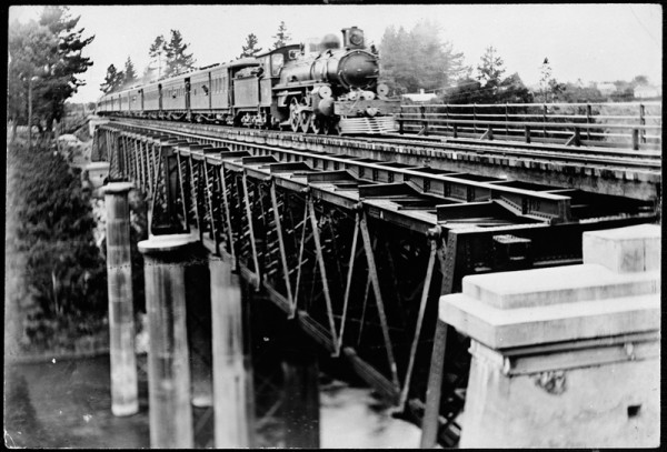
Express train crossing bridge over Waikato River, c.1912, HCL_02361
It’s not unreasonable to forgive the engineers and town planners in those early days their failure to foresee the invention of the motor car. That invention, leading to a steep rise in traffic volumes eighty years on, coupled with the very significant population growth, changed the face of central Hamilton streets. This railway line had been pushed across the city from Frankton in the days of horse drawn carts but, by the 1960s, life was being lived at breakneck speed (well, we thought so then).
In the 1890s branch lines to Rotorua & Thames opened followed by lines to Tauranga. In the 1950s Tokoroa and the Kinleith mill were to become major users of the railways. All this development placed a great burden on the line through Hamilton and in particular, the Victoria Street crossing. Delays grew at the crossing with longer and more frequent trains each day. In addition to those towns the line, stretching its tentacles across the eastern and south Waikato, Coromandel and the Bay of Plenty, now served industries and passengers to and from Morrinsville, Te Aroha, Paeroa, Waihi, Whakatane, Kawerau, Putaruru and Te Puke to name but a few.
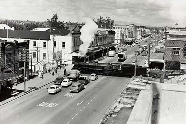
Train crossing Victoria St, 1959, HCL_02106
Victoria Street was a traffic bottleneck at rush hours, and as the trains took priority, the street could be closed off for several minutes at a time.
As early as 1912 the Hamilton Borough Council unsuccessfully suggested to the railway department that the line could be lowered and Council tried again in 1919. In 1929 Hamilton took a new proposal to the Railways that the line be redirected to the south end of Frankton. The Railway Department was unimpressed.
During the years 1900 to 1940 there had been significant increases in road and rail traffic and significant increases in delays at the level crossings.
By 1938 the Railways Dept had looked again at the idea of a lowered line and completed preliminary plans. The cost would be £529,000 – that is approx. $50,000,000 in today’s money. But this was money the Council could not contemplate on it’s own and the Railway Department seemed reluctant to take the lion’s share of the costs. No further progress was made until the National Roads Board decided it was a better option than any other being considered at the time; to provide a corridor to the south and relieve the city’s internal traffic congestion.
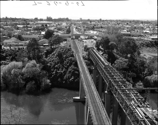
In September 1959 the Ministry of Works commenced the project which was to bridge the river twenty feet below the existing level, cut through to the west gradually rising to ground level at Frankton with traffic over-bridges at Tristram/Hinemoa, Seddon Streets and Lake Road. The days of level crossings were over. There were now five streets traversing Hamilton including Victoria, Anglesea and Tristram. Only traffic lights were now going to hold up the motorist.
The new bridge and underground line opened on 19th September 1964.
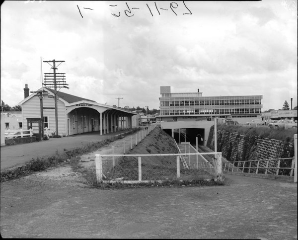
Hamilton Railway Station and lowered railway line, 1965, HCL_03571
The old bridge was no longer required for trains, but was repurposed for the increasing volume of vehicle traffic and became the Claudelands road bridge that still stands today.
Included in the new line was an underground station- Hamilton Central – beneath the Transport Centre where the Warehouse now stands. The rail line runs under Centreplace roughly midway between (and parallel to) Ward Street and Bryce Street. All the line between the river side of the ASB building and the west side of Anglesea Street is fully covered in. The line sees daylight again just to the west of Anglesea Street before Tristram Street.
The method of underground construction used is known simply and appropriately as ‘cut & cover’. A large cutting was excavated alongside the old Hamilton Station and covered over with concrete then filled with spoil. This effectively means that the railway that had once thundered its way across the Hamilton cityscape now slipped through a tunnel.
Initially the old railway yard was used as a car park until the building of Centreplace shopping mall and the Transport Centre which was built as the new home for the N.Z.R Road Services buses. New Government buildings were built where the Station had stood and to the unknowing eye today, there never was a railway crossing Victoria Street – there is no sign it was ever there.
New and old rail bridges, before the conversion from rail to road, 1967, HCL_03548